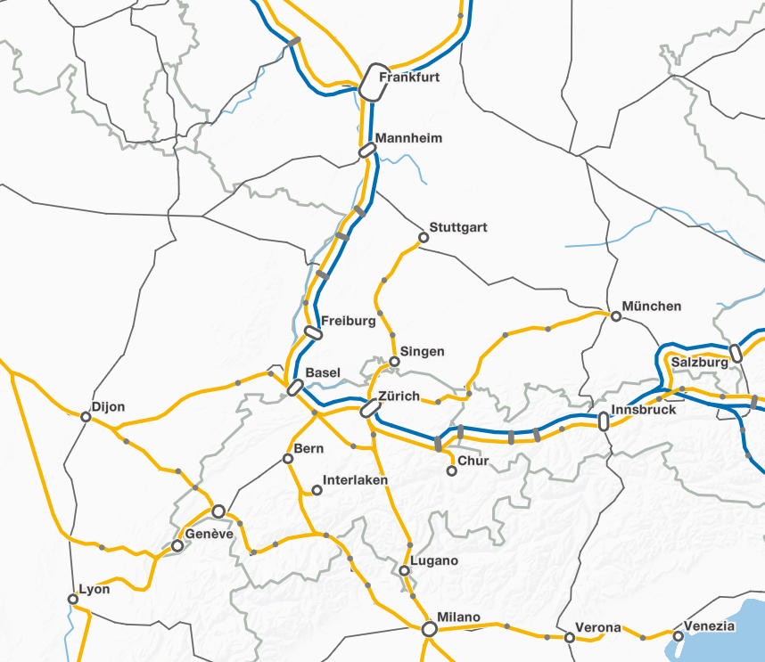
Through the use of open interfaces and standards, our applications can be seamlessly integrated into existing systems. We rely on established open source software for development and provide our products under open source licenses. Many customers can use our software license-free and mutually benefit from the enhancements and optimizations.
Altlast4Web
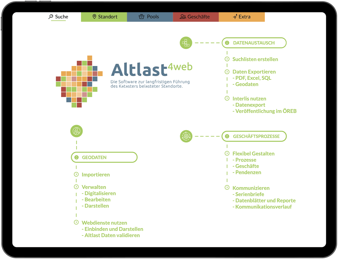
Altlast4Web 2.0 is a business control that is used in Switzerland and the Principality of Liechtenstein for the long-term management of the cadastre of polluted locations.
The federal law on environmental protection obliges the Swiss cantons and federal agencies to draw up a publicly accessible cadastre of polluted sites (KbS). geOps has been developing software for creating and managing KbS in Switzerland for over 15 years. With Altlast4Web we offer software that covers all aspects in this area of responsibility.
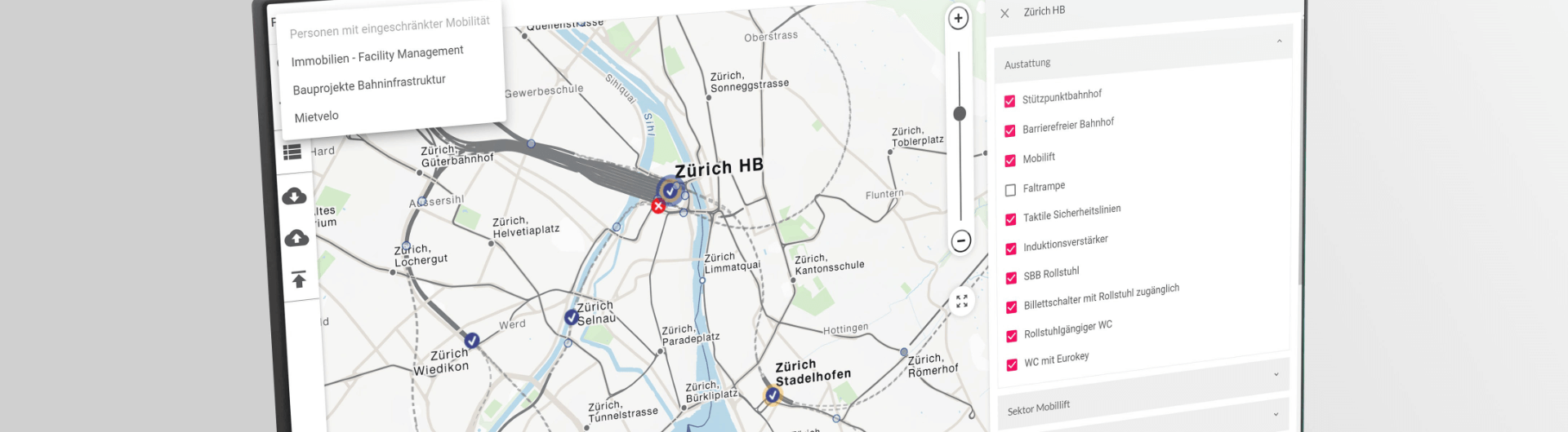
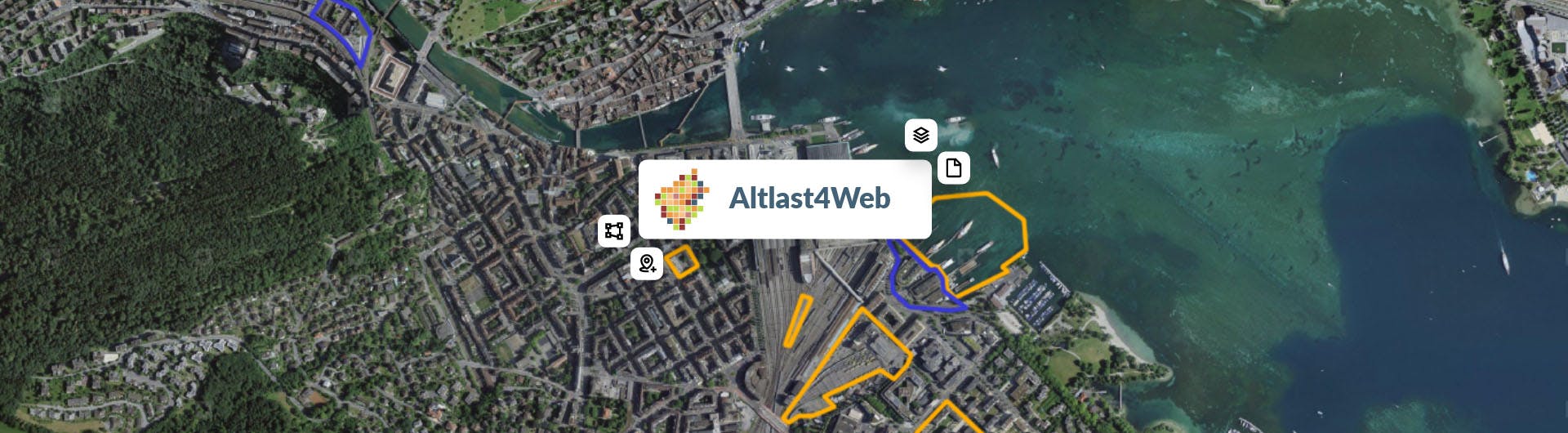
Not only all the relevant data for assessment and monitoring can be recorded with it. Thanks to the integrated geodata processing, the perimeters of the locations can be precisely digitized and displayed on various maps within Altlast4Web without the need for additional GIS software.
In addition, Altlast4Web contains a complete business control. Any processes can be modeled and transactions and pending tasks based on them can be handled. Individualized report templates allow the creation of data sheets and serial letters, either ad hoc or as an integrated step in the business process.
Numerous export options are available for data exchange. On the one hand, exports can be configured according to individual requirements and output in various geodata formats or in tabular form as EXCEL or PDF. On the other hand, Altlast4Web offers model-compliant exports in Interlis format, with which the requirements of the KbS as a geographic base data set or the requirements of the cadastre of public law restrictions (ÖREB) are met.
Altlast4Web is a web application that is completely based on open source software. The open source model enables use without license costs and further development according to the needs of all customers.
TreeApp
Forest management is characterized by long-term decisions that usually only affect the next generations. In times of climate change, it is becoming more and more important to make the right decision for the future of forests. On this subject, geOps has developed an app for tree species recommendations for the Swiss Federal Research Institute for Forests, Snow and Landscape WSL, which is intended to be an aid in making decisions about planting and caring for trees.
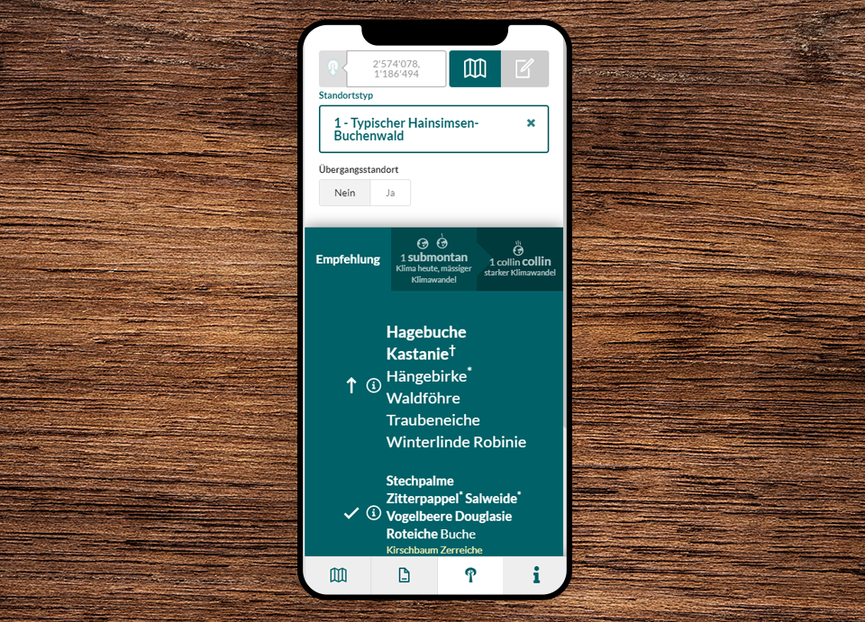
The fundamentals divide the forest into location types, which depend on the forest region and the elevation level of the terrain. With rising temperatures and less precipitation, the altitude levels will change or shift in the future. WSL research has designed two possible climate scenarios and their consequences for the altitude levels. The transitions between location types according to elevation level are determined with projection paths.
The logic from the research bases developed can be called up in a user-friendly way in a mobile web application for forest managers and all other interested parties.